


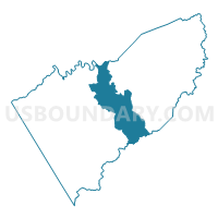
Courthouse Voting District, Floyd County, Virginia
About
Outline

Summary
| Unique Area Identifier | 681671 |
| Name | Courthouse Voting District |
| County | Floyd County |
| State | Virginia |
| Area (square miles) | 37.88 |
| Land Area (square miles) | 37.67 |
| Water Area (square miles) | 0.21 |
| % of Land Area | 99.45 |
| % of Water Area | 0.55 |
| Latitude of the Internal Point | 36.92569520 |
| Longtitude of the Internal Point | -80.34026470 |
Maps


Graphs
Select a template below for downloading or customizing gragh for Courthouse Voting District, Floyd County, Virginia


Neighbors
Neighoring Voting District (by Name) Neighboring Voting District on the Map
- Burns Fork Voting District, Floyd County, VA
- D-2 Voting District, Montgomery County, VA
- D-4 Voting District, Montgomery County, VA
- Indian Valley Voting District, Floyd County, VA
- Little River Voting District, Floyd County, VA
- Woolwine Voting District, Patrick County, VA
Top 10 Neighboring County Subdivision (by Population) Neighboring County Subdivision on the Map
- District D-01, Montgomery County, VA (13,543)
- Smith River district, Patrick County, VA (3,559)
- Little River district, Floyd County, VA (3,339)
- Court House district, Floyd County, VA (3,124)
- Burks Fork district, Floyd County, VA (3,014)
- Indian Valley district, Floyd County, VA (2,900)
Top 10 Neighboring Place (by Population) Neighboring Place on the Map
Top 10 Neighboring Unified School District (by Population) Neighboring Unified School District on the Map
- Montgomery County Public Schools, VA (94,392)
- Patrick County Public Schools, VA (18,490)
- Floyd County Public Schools, VA (15,279)
Top 10 Neighboring State Legislative District Lower Chamber (by Population) Neighboring State Legislative District Lower Chamber on the Map
- State House District 9, VA (82,064)
- State House District 7, VA (75,999)
- State House District 10, VA (68,822)
Top 10 Neighboring State Legislative District Upper Chamber (by Population) Neighboring State Legislative District Upper Chamber on the Map
Top 10 Neighboring 111th Congressional District (by Population) Neighboring 111th Congressional District on the Map
Top 10 Neighboring Census Tract (by Population) Neighboring Census Tract on the Map
- Census Tract 215, Montgomery County, VA (8,212)
- Census Tract 9201.01, Floyd County, VA (6,177)
- Census Tract 9202, Floyd County, VA (5,349)
- Census Tract 301, Patrick County, VA (5,060)
- Census Tract 9201.02, Floyd County, VA (3,753)